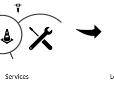
Master Thesis: Simulation-based Augmented Reality for Unmanned Aerial Systems Possible structure for the technical realisation of the thesis Unmanned aerial systems (UAS, aka „drones“) are becoming increasingly affordable, improving in functionality and quality, and are becoming more and more popular for both private and commercial users. They are utilized in a variety of applications ranging from amateur aerial photography to the distribution of crop protection agents in agriculture. In manual flight manoeuvres, a typical difficulty at high distances to the UAS is the intuitive determination of its orientation in the air. On the other hand, automated flights („autopilot“) for professional missions are often planned in advance but still require dynamic adjustments on-site, which should most intuitively be performed spatially in the environment and not only on two-dimensional maps. In addition, it is not always easy to estimate the field of view of the camera image when looking at the UAS. These and other problems can potentially be solved by augmented reality, another rapidly developing technology. In this case, additional information would be superimposed on the user’s field of vision, which – in the application described here – would enable the user to intuitively grasp the UAS’s status information. Such a system can also provide the user with additional processed data such as terrain models or airspace information. Task description In this work, a small drone should be connected to a simulation system based on the scenario „photogrammetry flights“ and the simulation system should be extended by the required components. This simulation system furthermore provides the basis for mission planning and communication between the drone and AR hardware (e.g. an ARCore-enabled smartphone or the Microsoft HoloLens 2). It also allows the integration of geodata and the use of simulation algorithms, for example, to determine additional information. Among others, the work can investigate the following questions: Does the camera and GPS-based localization of UAS available on the broad market allow a reasonable pose visualization in AR? What procedures are necessary/suitable to implement the calibration/registration of the coordinate systems of the drone and the AR hardware? Does AR-based visualization offer subjective advantages over common approaches? Keywords: Drones, Unmanned Aerial Systems, Augmented Reality, Photogrammetry, Data Visualisation Supervisor: Atanasyan

Weitere Arbeiten


MA: Automatisierung der Verhandlung von digitalen Nutzungsrechten durch Self-sovereign Digital Twins




![]()


![]()




Simulation-based Augmented Reality for Unmanned Aerial Systems
MA: Visual Enhancement of Simulated Camera Output using Generative AI...
MA/BA: Semantic Segmentation-based Road Material Detection and Mapping using Simulated...
Im Zuge der Digitalisierung und Verbreitung des Internet of Things...
Diese Masterarbeit untersucht die Anwendung von Linearzeit-Variationsintegratoren in experimentierbaren digitalen...
Master thesis: With the Industry 4.0 (I4.0) initiative, actors of...
With the Industry 4.0 initiative, actors of complex systems are...
With the Industry 4.0 initiative, actors of complex systems are...
Description Cooperative Simultaneous Localization and Mapping (SLAM) algorithms have garnered...
Masterarbeit: Heutzutage wird eine Vielzahl von Daten generiert und in...
BA/MA: Identitätsmodelle zur inter-twin Vernetzung von Digitalen Zwillingen Ein sicherer...
Ein Experimentierbarer Digitaler Zwilling (EDZ) ist eine virtuelle digitale 1-zu-1-Repräsentation...
One of the issues in reinforcement learning (RL) is generalization...
Probabilistic Programming Languages (PPL) combine the representational capability of programming...
Realistic simulation of urban landscapes, vehicle dynamics, sensors and traffic...
Klein- und mittelständische Unternehmen im produzierenden Gewerbe sind zumeist auf...
Klein- und mittelständische Unternehmen im produzierenden Gewerbe sind zumeist auf...
With the rapid advancement of digital technologies and sophisticated analytical...
Bachelorarbeit: Path planning for mobile LiDAR in outdoor environments Als...
Punktwolken, ob durch Laserscanner oder durch kamerabasierter 3D Rekonstruktion erzeugt,...
Architektur zur generischen Beschreibung von Szenarioverhalten
Generative KI-Verfahren wie z.B. umgesetzt durch ChatGPT sind aktuell in...
Im Rahmen dieser Arbeit soll das Konzept Experimentierbarer Digitaler Zwillinge...
Im Rahmen der Modellierung von Kinematiken werden Gelenkkörper modelliert und...
BA/MA: Digital Twins-Based Predictive Maintenance for Forestry Machinery Today’s forestry...
Ein grundlegendes Konzept von Industrie 4.0 ist die Vernetzung aller...
Bachelor-/Masterarbeit: Der Begriff IoT ist in der Industrie heutzutage nicht...
Master / Bachelor thesis: Generate a knowledge base from the...
Master / Bachelor thesis: Swarm algorithm for the adjustment of...
Master / Bachelor thesis: Visualisation of the knowledge base Expert...
Deep neural networks (DNN) have played a key role in...
The Internet of Things (IoT) is a federated cluster of...
Decentralization and networking of independent “things” is a current trend...
Technical systems are continuously evolving into more complex cyber-physical systems...
Bachelor-/Masterarbeit Bei klassischen IoT-Projekten sind Entwickler in der Regel mit...
In this work, a small drone should be connected to...
Bachelor-/Masterarbeit Mit der stetig zunehmenden Anzahl an die vernetzten Geräte,...
Ein proaktiver Digitaler Zwilling des Walds als Dreh- und Angelpunkt.
Die Modellierung der "Dinge" ist ein wichtiger Aspekt in Wald...
In this thesis, the GAIA-X approach of "federated services" shall...
Masterarbeit: Realisierung und Bewertung von KI-basierte und KI-gestützten Verfahren zur Simulation...
Simulationen finden immer häufiger Anwendung in industriellen Entwicklungsprozessen. Da hierfür...
Bachelor-/Masterarbeit: Integrating Network Simulation in a Multi-Domain Simulation Framework The...
Master Thesis: Integration of Wireless Communication Simulation in a 3D...
Vergleich und Bewertung von Qualitätskennzahlen aus verschiedenen Anwendungsbereichen
Methoden zur automatisierten Verifikation und Validierung numerischer Simulationsmodelle
Vergleich und Bewertung von Qualitätskennzahlen aus verschiedenen Anwendungsbereichen
Entwicklung eines räumlichen Partitionierungsschemas zur parallelen Simulation.
Automatisch generierte Wegenetze spielen eine wichtige Rolle bei der Simulation...
Moderne "Game Engines" haben hinsichtlich der eingesetzten Methoden sowie der...
Moderne "Game Engines" haben hinsichtlich der eingesetzten Methoden sowie der...
Entwurf und Realisierung eines Datenmanagement Systems für eine spezialgefertigte Anwendung...
Simulations-basierte Bestimmung der auf erdnahen Satelliten eingehenden Albedo- und Infrarot-Strahlungsleistung.
Entwicklung eines räumlichen Partitionierungsschemas zur parallelen Simulation.
Moderne "Game Engines" haben hinsichtlich der eingesetzten Methoden sowie der...
Die Nutzung von Simulationen im Engineering beginnt typischerweise mit der...
Die Nutzung von Simulationen ist aktuell im Wesentlichen Desktop-Applikationen vorbehalten....
In-Memory Datenbankmanagementsysteme für die verteilte Verwaltung und Bereitstellung von Modellen...
Für die 3D-Simulation stellt das STEP-Format ein wichtiges Mittel zum...
Modellbildung und Simulation weicher Körper innerhalb einer vohandenen Starrkörper-VR-Simulation
Integration eines geeigneten, erweiterbaren Reifenmodells in ein bestehendes Mehrkörpersimulations-Frameworks zur...
Nutzung von Techniken zur Abbildung von objekt-orientierten Strukturen auf relationale...


